

Key Takeaways
- Highway 1 offers breathtaking coastal scenery but presents real logistical challenges for larger RVs.
- Many pullouts and campgrounds along the route have strict length restrictions, often 24–30 feet maximum.
- Fuel stops can be widely spaced; planning tank capacity and refueling points in advance is essential.
- Driving in smaller segments — 50 to 80 miles per day — helps seniors enjoy the route without fatigue.
- Cell service and roadside assistance coverage are limited in several stretches between Big Sur and Morro Bay.
Unmatched coastal scenery in concentrated stretches
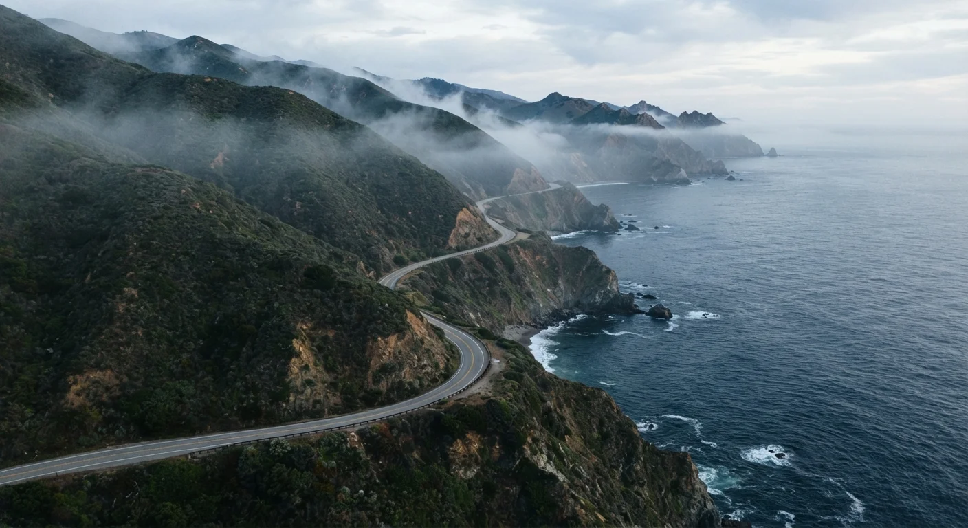
The Big Sur coastline, between Carmel and San Simeon, offers some of the most dramatic ocean views accessible by road anywhere in North America. Turnouts allow you to stop frequently and take in the scenery at your own pace.
Numerous senior-friendly campgrounds with full hookups
State parks and private campgrounds along the route offer a range of amenities, including electric and water hookups, restroom facilities, and proximity to accessible trailheads and visitor centers.
Naturally slow pace suits unhurried travel style
The road's curves and frequent points of interest make rushing impractical. Travelers who prefer to move slowly and stop often will find the highway naturally accommodates that rhythm.
Accessible coastal towns provide practical services
Towns like Cambria, Carmel-by-the-Sea, and Santa Cruz offer pharmacies, grocery stores, medical clinics, and restaurants — important infrastructure for seniors managing ongoing health or comfort needs.
Moderate year-round temperatures in many sections
Much of the California coast maintains mild temperatures through much of the year, reducing the extreme heat or cold that can make inland driving less comfortable for seniors.
Strict RV length limits at many campgrounds
A significant number of Highway 1 campgrounds cap rig length at 24 to 35 feet and may not accommodate slide-outs. Travelers with larger motorhomes may find their options severely limited without thorough advance research.
Narrow, winding lanes require sustained concentration
The tight curves, minimal shoulders, and periodic one-lane sections through active construction or slide repair zones can be physically tiring for drivers over extended periods, particularly for those with vision or reaction-time considerations.
Unpredictable road closures from slides and erosion
Highway 1 is prone to rockslides and coastal erosion, and closures sometimes last from days to several months. Itineraries must allow for potential significant detours, often routing inland via US-101.
Limited cell service and emergency access in key stretches
The Big Sur region in particular has significant gaps in mobile coverage, which can delay navigation assistance, emergency services, or communication with family. Satellite communicators may be worth considering.
Fuel scarcity and high prices between towns
Gaps of 50 or more miles between fuel stations exist in the Big Sur corridor, and prices at available stations are often substantially above regional averages. Low-tank driving is not advisable.
Our Verdict
The Pacific Coast Highway is genuinely spectacular, but it rewards preparation far more than spontaneity. For senior RV travelers willing to plan carefully — choosing the right rig size, reserving campsites well ahead, and setting unhurried daily mileage — it delivers an experience that's hard to match anywhere in the country. Those with larger Class A motorhomes or limited driving confidence on mountain curves may find the route stressful rather than relaxing.
Best suited to senior travelers with smaller or mid-size RVs (under 30 feet) who enjoy slow, scenery-focused itineraries and have done advance research on campground availability and road restrictions.
What Makes Highway 1 So Appealing — and So Demanding
The Pacific Coast Highway, officially California State Route 1, runs roughly 650 miles along the California coastline, threading through redwood groves, perched above sheer ocean cliffs, and dropping into artsy coastal towns. For many RV travelers, it ranks near the top of any bucket list. The views — particularly through the Big Sur corridor — are genuinely extraordinary.
But the same geography that makes it stunning makes it demanding. The road is narrow, frequently one lane in each direction, with tight curves and minimal shoulders. Rock slides are common, and closures — sometimes lasting weeks — can redirect entire itineraries without warning. Understand these realities before you commit, and the drive becomes manageable. Ignore them, and it can become a source of stress rather than joy.
For a broader look at routes designed specifically for unhurried senior travel, see America's most scenic RV routes for slower-paced exploration.
Unmatched coastal scenery in concentrated stretches
The Big Sur coastline, between Carmel and San Simeon, offers some of the most dramatic ocean views accessible by road anywhere in North America. Turnouts allow you to stop frequently and take in the scenery at your own pace.
Numerous senior-friendly campgrounds with full hookups
State parks and private campgrounds along the route offer a range of amenities, including electric and water hookups, restroom facilities, and proximity to accessible trailheads and visitor centers.
Naturally slow pace suits unhurried travel style
The road's curves and frequent points of interest make rushing impractical. Travelers who prefer to move slowly and stop often will find the highway naturally accommodates that rhythm.
Accessible coastal towns provide practical services
Towns like Cambria, Carmel-by-the-Sea, and Santa Cruz offer pharmacies, grocery stores, medical clinics, and restaurants — important infrastructure for seniors managing ongoing health or comfort needs.
Moderate year-round temperatures in many sections
Much of the California coast maintains mild temperatures through much of the year, reducing the extreme heat or cold that can make inland driving less comfortable for seniors.
The Logistical Realities: Road, Rigs, and Campgrounds
RV size is the single most important variable on this route. Many state park campgrounds along Highway 1 — including Pfeiffer Big Sur and Kirk Creek — post maximum length limits, commonly between 24 and 35 feet. Slide-outs may further limit your options. Travelers with larger Class A coaches should research each stop individually and consider whether the route is compatible with their specific rig.
~35 ft
Typical maximum RV length at Big Sur campgrounds
Many California state park campgrounds along Highway 1 post vehicle length limits; always verify with the specific park before booking.
50+ miles
Longest fuel gap in Big Sur corridor
Some stretches between Carmel and San Simeon exceed 50 miles without a fuel station, making tank monitoring a practical necessity.
Fuel is another practical concern. Stretches through Big Sur can exceed 50 miles between service stations, and prices at the few stations available tend to be significantly higher than inland averages. Check your tank capacity and calculate conservatively before leaving any larger town.
Cell service drops out across substantial sections of the route. This matters for navigation, but it also affects roadside assistance response times. Downloading offline maps and carrying a paper backup is worthwhile. Travelers managing health conditions or medications who rely on regular pharmacy access should plan their stops around towns with services — Cambria, Morro Bay, Carmel, and Santa Cruz all offer practical infrastructure.
Strict RV length limits at many campgrounds
A significant number of Highway 1 campgrounds cap rig length at 24 to 35 feet and may not accommodate slide-outs. Travelers with larger motorhomes may find their options severely limited without thorough advance research.
Narrow, winding lanes require sustained concentration
The tight curves, minimal shoulders, and periodic one-lane sections through active construction or slide repair zones can be physically tiring for drivers over extended periods, particularly for those with vision or reaction-time considerations.
Unpredictable road closures from slides and erosion
Highway 1 is prone to rockslides and coastal erosion, and closures sometimes last from days to several months. Itineraries must allow for potential significant detours, often routing inland via US-101.
Limited cell service and emergency access in key stretches
The Big Sur region in particular has significant gaps in mobile coverage, which can delay navigation assistance, emergency services, or communication with family. Satellite communicators may be worth considering.
Fuel scarcity and high prices between towns
Gaps of 50 or more miles between fuel stations exist in the Big Sur corridor, and prices at available stations are often substantially above regional averages. Low-tank driving is not advisable.
Pacing the Route for Senior Comfort
The most common mistake on Highway 1 is treating it like a standard driving day. The curves, the traffic from tourist season (generally spring through early fall), and the constant pull of overlooks mean that 60 miles can take three to four hours. Plan daily mileage of 50 to 80 miles maximum and build in genuine rest days.
Driving direction also matters. Northbound travelers have the cliff side on their left, which places them closer to the drop-off edge. Many experienced RV travelers prefer a southbound direction — Monterey toward San Luis Obispo — which keeps the mountain wall on the driver's side and the ocean view accessible from the passenger window. There's no universal right answer, but it's worth considering before you start.
Check Road Conditions Before You Depart
Caltrans maintains a current road conditions and closure map for Highway 1 at its official website. Conditions can change rapidly after rain events or seismic activity. It's worth checking the morning of any driving day, not just during initial trip planning. The Caltrans QuickMap tool is free and updated in real time.
For travelers who prefer company on the road, solo senior RV travel considerations are worth reviewing even if you're traveling with a partner — the route's communication gaps make any contingency planning relevant.
If you're weighing Highway 1 against a less technically demanding coastal alternative, our comparison of Gulf Coast and Pacific Coast RV camping outlines how the two experiences differ in terrain, infrastructure, and pace.